Wednesday, March 15, 2006

INCHING CLOSER TO REALITY


INCHING CLOSER TO REALITY
A Personal Account Of The Mount Everest Base Camp Trek in Nov 2004


Aniket Anikhindi
March - April 2006


Sunday, March 12, 2006

Sharing the success story..


Anup Mathkar

Vinod Sairaman

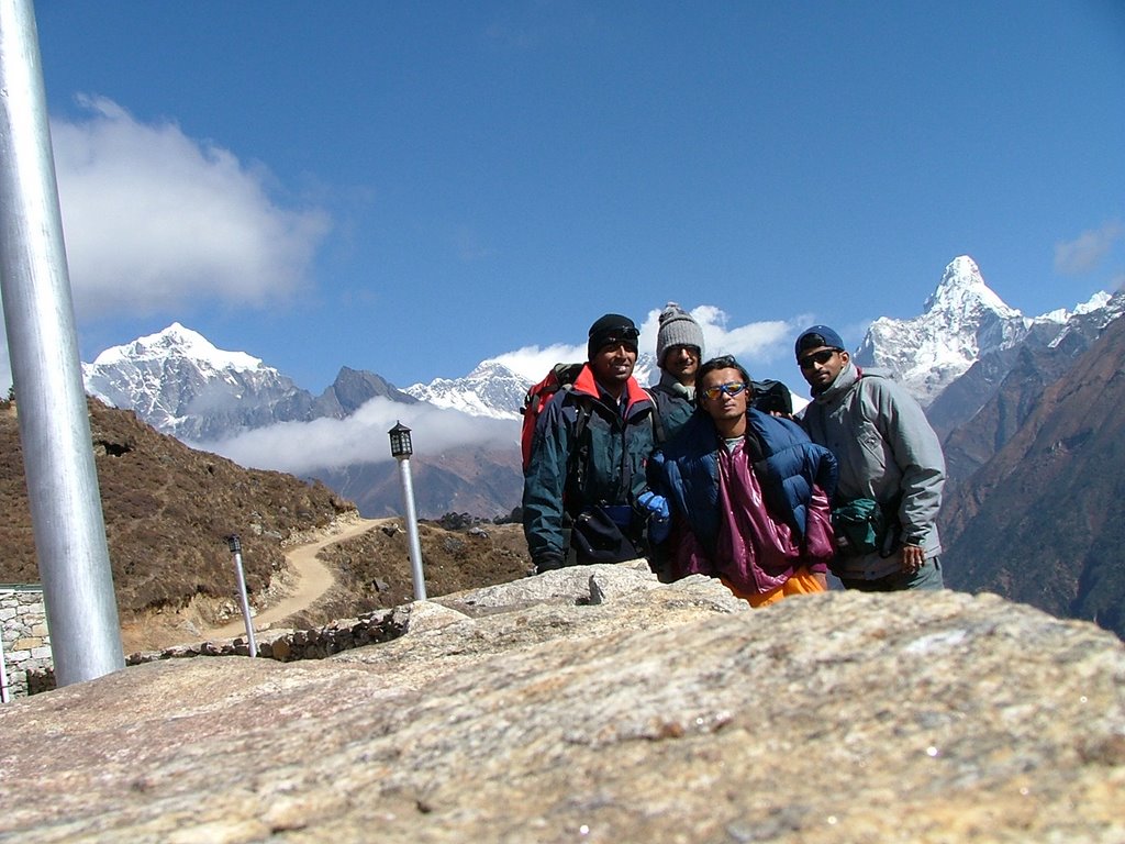
My fellow trekkers, with whom I spent two weeks and shared the true spirit of the trek. Indeed, trekking is a test of individual endurance, stamina and mental strength but at the same time positive teamwork plays a very important role in this sport.


Anish Rawal (Rawal bhai)

Our guide for the trek, who helped us right from getting good bargains at accommodations, suggesting us the right path to follow, to taking the most sensible decisions in order to maximise the probability of successfully completing the trek. Being a guide is one part, being a good guide is another - in order to help a client succeed in his/her aim. Rawal bhai's role was pivotal in this aspect.

Lal Bahadur Sherpa (Lal bhai)

Our porter who carried close to two thirds of our entire luggage. In making our trek look so easy, equal credits go to him. Not only did he play a crucial role in carrying 2 of 3 backpacks, but also in securing accommodation for us at our destination for the day. I remember him walking twice as fast as us or even faster at times (this comes naturally to the Sherpas). He was our strong hero, though looks are very deceptive when it comes to the remarkable clan of Sherpas.


Gurkha Encounters, Nepal

The trek organisers whom we were taken to, for obtaining flight tickets from Kathmandu to Lukla. After sharing our trek itinerary plans with them and talking to Mr. Rajendra Bajgain (Raj, as we call him), we felt the services they were offering would help us in successful completion of the trek that meant a lot to us. Our guide (Rawal bhai, as mentioned above) happened to be working for this organisation, and it was Raj who introduced us to Rawal bhai and set us on course. I do appreciate the services provided to us by Gurkha Encounters, and therefore they deserve a special mention here.

Those who mattered the most

Dedicated to

Chandrika Srinivasan

For proposing the idea that set this entire episode rolling. For us, it was a dream come true, an unforgettable experience of a lifetime. The biggest paradox was that situation forced her to opt out. I missed her all through the trek and I sincerely hope that she makes it to Base Camp very soon.

With special thanks to

Madhukar Bhatia

For being a very important contributor in terms of injecting within us a total positive attitude towards our task. To put it in better words, he did the job of pumping adrenaline within us to take the final leap. His experienced words put to rest all doubts we had before starting off for our trek. They were very influencing.

AND

Geetalekha Prabhu
Amit Punde
Harpreet Singh Gandhi

Looking back after returning from the trek, I can certainly say that one of the biggest asset a trekker can have is words of experience. I express my heartfelt gratitude towards these people for providing valuable inputs and sharing their experiences which helped us immensely in our planning.


The backbone

I appreciate the support extended by my parents who were generous enough to let me grab this opportunity and go for this trek at a point in time where my presence at home was more than necessary.

I will always remember Shraddha, my dear sister, for not minding me travelling for the trek just a couple of days after her marriage.

I also appreciate the love and encouragement showered by my friends and close ones, who extended their good wishes for the successful completion of our trek.

PREFACE

It was sometime around August 2004 when the first round of discussions regarding going for a thrilling trek, began. Chandrika Srinivasan (a college friend) initiated the talks. I was more than happy to talk about my long-standing dream – visiting the Himalayas – a thing from which no truehearted trekker can stay away especially once he or she has already been there, as had been true in my case.

As a well-known saying goes: "Low aim is crime". We planned therefore to kiss the feet of none other than the tallest mountain in the world. Tibetan people know this great mountain by the name Chomolungma, the Nepalese call the mountain Sagarmatha and the world knows her by the name Mount Everest. To summit Everest was out of question at this stage with lack of exposure to professional mountaineering, but trekking to South Col Base Camp (Mt. Everest Base Camp, from the Nepal side) was going to be equally exhilarating for us. Photographs and experiences shared by our trekking associates (who had been along that trekking route a couple of years before) were captivating enough to develop within any truehearted trekker a burning passion to be there.

As I look back on the days I spent on the trek, I get the assurance over and over again that I have found a concrete aim towards which probably every person is inching to in his or her life. And to lay a foundation stone for the same, I felt penning down my thoughts and my experiences during the South Col Base Camp trek would be the best beginning. This book attempts to blend together my personal account of the trek along with the reflections of the Sherpa culture – the devout Buddhist mountain people whose forebears migrated southward from Tibet centuries ago.

This trek was not like the couple of Himalayan expeditions I had previously been to, which some organisation had neatly chalked out. Here, we had to work out things ourselves that included gathering information about anything and everything that related to our trek, working out suitable dates, booking tickets, renting trekking equipment and most importantly, having contingency plans ready. A lot of thought process had to be put in to plan things to the minutest of details. Neither was it an easy decision to make nor was it a picnic/trip that one could casually plan out and expect to work according to the itinerary.

For the long, arduous trek that lay ahead of us, we scheduled regular physical endurance building sessions. Especially in the wake of the fact that we were software engineers, restricted to the confines of an air-conditioned workplace, with regular exercise to no other body part except the carpus. Our stamina building sessions mainly included trekking a well-known mountain in the Sahyadri range, by the name Sinhagad. Very soon, we got used to climbing with 20 – 25 lbs backpacks on the averagely steep graded mountain. I must say, this entire activity worked out very well for us, both physically and mentally. Endurance was the factor that was of critical importance on this trek taking into consideration the long miles to walk on undulating ridges of the Himalayan terrain. The biggest of challenges for us were survival in extremely cold weather coupled with chilly winds, and the “deathblow” factor - very high altitude (surviving over 14000 feet or 4250 metres).

We were totally affirmative about making it to our dream destination albeit some practical uncertainties loomed until as late as a week before we departed. But good luck, strong will power and optimism, probably in that order, made our embarking possible. We were set to trek to South Col Base Camp (Mt. Everest B.C., Nepal side) and Kala Patthar, in the cold month of November, towards the end of fall 2004.

Prelude

Trekking has been my most closely sustained hobby for nearly a decade now. Just before I attended junior college, I was lucky to get a chance to go on my first long distance trek. I remember clearly, it was the spring (pre-monsoon) of 1995, when my friend's father, an avid trekker gave me a tempting offer to join the National Himalayan Trekking Expedition on Babeli – Malana – Chanderkhani Pass route in the Kullu – Manali valley of Himachal Pradesh (India). The trek was organised by a well-known organisation by the name ‘Youth Hostels Association of India’. The highest altitude we had attained on the trek was about 4250 metres (over 14000 feet). From Chanderkhani Pass, one gets an extensive panorama of the Bara Bangal, Pir Panjal and Parbati ranges in the Himalayas.

Exactly couple of years from then, the spring of 1997 gifted me with a totally unexpected opportunity. Three friends of mine had planned for a trek to the Himalayas. Just a couple of weeks before their departure, one of them broke his ankle in a rough football session. That opened up a chance for me, and I was more than glad to go back to the ever-beckoning snow capped peak region. This time, I was part of the Himalayan Exploratory Trekking Expedition in the Nargu / Shuhar valley of Chhota Bengal on the Dhauladhar range of Himalaya in Himachal Pradesh (India). The trek was organised by ‘Abhiyan Adventures’ – a voluntary task force of adventure lovers. It was yet another trek in which I reached the altitude of over 4250 metres (14000 feet) above mean sea level.

From there onwards, I had to focus on getting my degree in Computer Science and I did not get a serious chance to do long distance treks. But living in a state called Maharashtra was one lucky thing for me. This state is gifted with the Sahyadri range of mountains/forts, which are pretty rugged, but have their own importance and charm. They certainly gave me a good chance to keep my favourite hobby alive. Though I gained no experience in high altitude trekking here, I did get a chance to do some technical climbing - doing steep graded terrains, varieties of tough rocks to climb, apart from long, rigourous walking.

TO WRITE: (2/3 paras on general treks to sahyadris)


TO WRITE: (thirst to visit the Himalayas)


TO WRITE: (ways of keeping alive memories – photographs, etc. writing a book or blog book – life time thing)

TO WRITE: (detailed para on what is my view of the term ‘inching closer to reality’)

Departure from Mumbai

There were many, many fine reasons not to go, but attempting to climb Everest is an intrinsically irrational act - a triumph of desire over sensibility. Any person who would seriously consider it is almost by definition beyond the sway of reasoned argument.

Jon Krakauer
Into Thin Air


It was all like a vision we had which was turning out to be successful. The first step of which was our flight to Kathmandu. We reached Mumbai about an hour and a half before our scheduled departure time of 07:45 pm. As we came to know later, our flight carrier - Royal Nepal Airlines never arrived on time. We got to experience it as well, and we were worried the delay might just turn out to be too nasty for us. The flight took off at 11:10 pm (nearly 3.5 hours late), and reached Kathmandu at an odd hour of 01:30 am.

As per our calculations, we were counting on a couple of hours after reaching Kathmandu and another couple of hours of the following morning for renting essential trekking gear. We feared that the delay in the Mumbai – Kathmandu flight could potentially trigger off a cascading set of unwanted events, the first being an extra day’s stay at Kathmandu. We had already come packed with a barely adjustable schedule, and the last thing we wanted was to start compromising on the number of days that we had reserved for the actual trek (i.e. the number of days apart from those spent in travelling to and fro).

After a tiring wait for our luggage at Tribhuvan International Airport in Kathmandu, we contemplated the thought of waiting at the airport itself to book an early morning flight to Lukla, which would have guaranteed that there would be no change in the itinerary. It seemed too ambitious a plan; rest was the need of the hour. Right at the airport exit we bumped into one Mr. Meghraj Tiwari who was quick to realise we were tourists and by the look in his eyes, he seemed to be saying ‘welcome my prey’. He immediately flashed out an identity card that proved him being Nepal Government authorised travel agent. We didn’t seem to have any other option than to accept his help, and what he said seemed to be pretty reasonable.

He claimed he would arrange for the night’s stay for us and would try his best to get the Kathmandu – Lukla flight booking done for us on the following morning. It was very nice of him to personally accompany us at that odd hour (being a localite made all the difference), to a hotel where we were to spend the night. It was a good hotel, by the name 'Hotel Lai Lai', pretty much in the heart of Kathmandu, approximately 8 kilometres from the airport. I doubt if the hotel owner would have woken up at that odd hour if Mr. Tiwari had not been there.

We were already running short on time with respect to sleep though it still took us 04:30 am before dozing off. We had a hectic day ahead.

A Day In Kathmandu

Kathmandu is the capital city of Nepal. It is a city of nearly half a million people in a valley by the same name in central Nepal, near the Vishnumati River.

Kathmandu is said to have been founded by King Gun Kamdev in 723 AD. According to legend, the area was a lake in the past, but the Hindu God Manjushri cut open a hill to the south and allowed the water to flow out, making the region habitable. The origin of the present name is unclear, but one of the more likely theories is that it was named after Kastha-Mandap ("temple of wood" in Sanskrit), after a pagoda carved from the single tree on the order of King Lakshmi Narasingha Malla in 1596.

Once thought to be the fabled and inaccessible Shangri-La, Kathmandu is now a hub for independent travellers as well as a growing vacation spot catering to all budgets. Kathmandu itself has limited activities for visitors beyond the amazing sightseeing and general experience of being there, but it is the starting point for numerous adventures in the rest of the country including trekking, rafting, jungle adventures, and more extreme sports.

Wikipedia, the free encyclopedia


Our late night sleep effectively meant our day in Kathmandu was going to start late. Though we got up at 08:30 am (after barely 4 hours of sleep), we managed to push off from our hotel only by 10:00 am. The gentleman who had arranged for our stay the previous day (Mr. Meghraj Tiwari) was already waiting for us in the hotel’s lobby. He was supposed to make further arrangements for our flight to Lukla, on the same day if possible. If we were to live by our schedule, that was a must.

On arriving at a travel company's office (Gorkha Encounters Pvt. Ltd, Thamel, Kathmandu) that Mr. Tiwari took us to, unexpected news was delivered to us. It was about 10:15 am, and we were told that the last flight to Lukla departed at about 11:00 am. There was no probability of making it to Lukla on the same day to start our trek as per plan. Our fear turned into reality - a day was lost right away courtesy delayed service by Royal Nepal Airlines the previous night.

The travel company arranged for our flight tickets to Lukla for the next morning (10th November) and suggested that we go in for a ‘complete package deal’ for the entire trek. This package deal included the flight ticket to Lukla, a cook who would accompany us all through the trek, a guide for the trek, porters who would carry stoves, camping gear and our backpacks. Luckily enough we had experienced people who had given enough information about the trek and we were in no need whatsoever of any such package deal. But we did hire a guide for the trek. Enroute Mount Everest Base Camp, you actually do not need a guide as far as the trail is concerned, but a guide does matter in many ways, as time was to tell. We were doing it all to make sure that we maximised our probability of completing the intended trek on which the guide is one person who happens to know more about your health than you would.

Trekking to Mount Everest Base Camp is not where serious technical climbing is involved. Neither does one have to do hazardous rock climbing nor rappelling. One does have to trek over undulating ridges, but that happens to be the typicality of any long distance trek, especially in the Himalayas. This trek is more of a test of one’s physical stamina to trek on considerably steep graded terrains over a long distance, adjusting to cold weather, chilly winds and the killer factor - very high altitude. A good guide can make all the difference by being able to judge the abilities of his clients, and guide them in a way such that they can achieve their aim. On asking Madhukar (the person who was the source of inspiration for our trek) how one could overcome all these challenges, he had a noteworthy reply: “It’s all mental”. In hindsight now, I can’t agree more – the moment where one gives up mentally, the deal is over.

We spent some time around the famous Thamel Street in Kathmandu before arriving back to our hotel for lunch. Thamel area is one of the most popular tourist areas of Kathmandu – a 15 to 20 minute walk from the centre of Kathmandu. Thamel has clean narrow streets full of mushrooming lodges, hotels for budget travellers. Restaurants, bars and other tourist-oriented shops can be seen bustling with activities. A couple of months before we arrived, Kathmandu was under the siege of the Maoists (rebels who were trying to force Communism onto the Nepali people through acts of terrorism). We were relieved to be able to roam freely around town without any hindrances whatsoever.

On the second trip to our travel company's office in the evening, we were introduced to our guide-to-be, Mr. Anish Rawal (the name used throughout the article is Rawal bhai). He happened to be a very friendly person, younger in age to the three of us, a slim, short guy who sounded very positive. He came to aid right from that evening - in getting us a good bargain while renting our trekking gear - that consisted of down jackets (chill wind, rain and snow proof thick jackets - fleece inline), chill wind proof gloves, and a few medicines. The most critical of which was dexamethasone - the well-known drug that gives temporary relief in case of altitude sickness.

It was after spending considerable time gathering our trekking essentials and talking to Rawal bhai, which convinced us that spending a day in Kathmandu, actually worked in our favour as opposed to hampering our schedule. In fact, I now wonder how would we have managed had we not spent this day in Kathmandu.

Meanwhile, we'd got Indian currency exchanged with Nepalese. Although Indian currency is accepted in Nepal, we did not want to take any chances. As long as we were in the city region, there would have been no problems, but we could not take a gamble since we would be dealing in the mountains. A denial to accept Indian currency up there would leave us begging for money. A useful tip for those Indians who intend to go to Kathmandu is that currency notes in denomination of 100 INR or lower are the only ones to be accepted.

The fact that Indian currency was stronger than Nepalese currency gave us something to cheer about. 100 INR fetched us 160 Nepalese Rupees, and we were just expecting life to be less costly. Only time was going to prove it otherwise. Anyhow, a peaceful dinner at our Hotel Lai Lai and an early night's sleep marked the end of the day. We were expecting that November the 10th onwards, the flight to Lukla and the first day of the trek would mark the beginning of the much-awaited excitement.

The flight to Lukla

The first Everesters were obliged to trek 400 arduous miles from Darjeeling across the Tibetan plateau simply to reach the foot of the mountain. Their knowledge of the deadly effects of extreme altitude was scant, and their equipment was pathetically inadequate by modern standards.

Jon Krakauer
Into Thin Air


The first few attempts on Everest were made from the Northeast Ridge, the base camp of which is at the origin of the East Rongbuk glacier in Tibet. Not because it was easier, but since it was the only available route for aspiring Everest climbers. Post 1949, when Nepal opened its borders to foreigners, majority of the expeditions on Everest have chosen the Southeast Ridge route, the base camp of which is at the origin of the Khumbu glacier in Nepal. Everesters used to follow the now less heard of Jiri trail, which takes over a week to reach Lukla. And now the simplest way to reach Lukla (situated at 2840 metres) from Kathmandu is via a breathtaking flight, which takes not more than 35 minutes – most of the trekkers choose to take this for saving time while a rare few take it as a joyride.

The departure time of our flight to Lukla was 08:05 am. It was therefore pretty much necessary to get up at an early hour like 06:30 am or so to make it in time. The early-to-bed, early-to-rise way of life in the mountains was already being practiced. We got to Tribhuvan International Airport at Kathmandu, and got our bags checked in. The flight to Lukla is purely a mountain zone flight, and our carrier was a twin otter plane that had a seating capacity of 22 people. The luggage restriction per person was understandably a meagre 15 kilos. Typically, carrying more than 15 kilos on a high altitude trek would completely exhaust an average human being (Sherpas excluded) in less than half an hour.

From Kathmandu, the flight to Lukla takes about 30 minutes, but fog and clouds often delay early morning departures. Due to this unreliability there are often backlogs of frustrated trekkers waiting for flights to Lukla and back. We were blessed by clear weather and soon after, we were aboard our plane, the flight carrier being 'Yeti Airlines'. Cabin service on the twin otter DHC-6 consists of passing around a tray of earplugs and getting one hard candy each. It was an excellent start; I got to sit right behind the pilot! Barely 2 feet away from the cockpit my hands were itching to fiddle with some of the controls on the panel. Good sense prevailed, of course.

We were soon flying high over Kathmandu, and in less than 10 minutes, there was no trace of any inhabitation below. We were amidst mountains, and ranges capped with snow made their appearance in a short while. The view of those lovely peaks basking in the morning light was not something I can best express in words. Probably the photographs might give one an idea, if not the total feeling. All I can say is that the view pumped into us an enormous amount of desire and will power to conquer our goal. We were held in awe, as we flew at about 33000 feet above mean sea level. Amidst the snow-capped peaks, the mighty Mount Everest was visible as well, albeit for a very short interval. We barely managed to get a glimpse to be true.

In no time thereafter, the small airstrip at Lukla was visible. The flight did not take longer than 35 minutes. But I spared no efforts to get some good snaps from my digital camera. I went right next to the pilot, and made sure to click a few snaps of the mountain ranges and the airstrip from right behind the windshield of the plane. The simple reason for taking such a step was the outcome of the fact that my seat in the plane was on the opposite side from where the Everest mountain range was visible.

The approach to Lukla's steep airstrip is interesting. If you overshoot the runway, you hit the mountain so there is only one chance to get it right. The airstrip at Lukla is just 1900 feet in length but stands on a 9% incline to aid the pilots in braking. In our case, an abrupt sort of landing followed wherein only the right tyre of our twin otter hit the airstrip first, and then the left and centre forward tyres touched the ground. The plane swerved little to the right first, then in an attempt to control it, the pilot swerved an extra bit to the left, finally managing it to get it moving in the direction intended just in time before the turn to the right.

Lukla happens to be a scenic Sherpa town situated at an altitude of 2840 metres. It is a small community of houses, farms and shops, mostly catering to the trekkers coming from the airport – an airport that Sir Edmund Hillary had built to ship building materials for Sherpa houses and schools. The hiking trail started as soon as you exited the baggage claim room.

When you land in Lukla you are at the base of the Khumbu region. At an altitude of over 9,000 feet, the Lukla air is cool and decidedly thinner. Aromas of juniper fires, yak dung, and helicopter exhaust wash over you, displaced by a light breeze of glacial air flowing down from the Khumbu and Tibet. The smell of Everest.

Lukla (2840 m) - Phakding (2610 m)

From Lukla the way to Everest led north through the crepuscular gorge of the Dudh Koshi, an icy, boulder-choked river that churned with glacial runoff.... It was magnificent country, as topographically imposing as any landscape on Earth, but it wasn't wilderness and hadn't been for hundreds of years.

Jon Krakauer
Into Thin Air


It was our dream starting to come true. We were at the place from where our trekking was to begin. Our guide, whom we addressed as Rawal bhai, got hold of a porter who would take care of part of our luggage. His name was Lal Bahadur Sherpa, and we addressed him as Lal bhai. It’s generally customary to call a younger one 'bhai', and an elder one 'dai' in Nepal. Both our guide and porter were younger to us, hence the suffix. Even though they were younger, they were the pivotal elements of our trek.

Whether to carry one’s own luggage as opposed to hiring a porter on a trek is a decision every trekker has to make, and this is governed by a lot of factors. Its not only physical ability to bear load over long distances or across steep graded terrains; at higher altitudes even the smallest of activities makes one gasp for breath. And this goes without saying that the first aim of every trekker is to reach the final destination – to first survive at higher altitude, and then target being totally self-reliant. Having done enough practice of carrying backpacks over the past months, we decided not to let the porter carry our entire luggage. We were three of us, and we decided that we would let the porter carry two backpacks, while we would be taking turns at carrying the third backpack. There was some challenge as well in this, even if trekking purists might not take it that way.

Lal bhai got the luggage tightly roped so that he could carry it comfortably. These Sherpas are really a remarkable clan. They can easily pull up 20 kilograms of load and we saw Sherpas carrying as much as 50 kilograms or even more individually. It is recommended though that one person should not be loaded over 20 kilograms, for the basic sake of being humane to them. Apart from bearing loads (porting) for earning a living, for Sherpas it is a matter of pride to successfully carry loads for their clients so that they can expect to be selected for further expeditions and live to their reputation. Monetary aspect, although important, is secondary for them. Sherpas used to be traders till about 1921, when the first British Expedition to Everest decided to engage Sherpas as helpers. As Jon Krakauer has mentioned in his book Into Thin Air, this decision of the British expedition sparked a transformation of the Sherpa culture. They already had a reputation for being hardworking, affable and intelligent. But what they possess as an unbeatable advantage is the fact that they had lived for generations in villages situated between 9,000 to 14,000 feet, therefore being physiologically adapted to the rigours of high altitude.

Rawal bhai carried my sleeping bag along with his luggage, and I carried the remainder of my backpack. I bought myself a comfortable waist pouch to carry frequently needed items like the digital camera, my wallet and some currency notes. I recall that the time was past 11:00 am when we started off for the first day’s walk. We started only after we had our breakfast at the famous 'Himalaya Lodge'. We were advised to have garlic soup as an integral part of every meal - it acted as an energy booster as well as the natural medicine for altitude sickness.

As we set our first foot towards our destination for the day (Phakding), we were pretty pleased just to realise that we were in the bosom of the Himalayas. The first day's trek was a 6 km (mostly) downhill walk, about 200 vertical metres to descend. The walk was along the banks of the river Dudh Koshi, which flew in between two huge mountain ridges on either side. The panoramic views we got to see left us astounded. We had to cross the Dudh Koshi on many occasions, over bridges ranging from small wooden ones to large Swiss suspension bridges. It was like a slow paced joyride on these long bridges.

Along the riverbanks, the chilly wind made the walk further pleasant on the first day. This might sound a bit weird, but the fact lies that walking, as an activity, generates enough warmth. Add to this the heat radiated by the sun during the afternoon. A cool breeze at lower altitudes is therefore very soothing. Anyhow, we were soon slowed down due to a lot of pedestrian traffic and yaks. Trekkers would always be running into some yak and cow-yak caravans as they move north. They look gentle enough as they meander along, kind of like a herd of cows. But yaks can have nasty dispositions. They've been known to severely hurt people. The preventive method is to stay out of their way! Majority of the yaks seen on the way though are crossbreeds of yak and cattle, the male variety of which is termed dzopkyo and the female dzom. Purebred female yaks are termed naks but the term is very less used and thereby less known. One often gets to see the item “yak cheese” on the menu, whereas it is technically impossible to have such a thing!

The last of the hurdles included the Sherpa porters who were carrying heavy loads on their backs. As soon as we would get a broad path to walk on, we would overtake them, feeling pretty energetic, this being just the start. Though I must admit that majority of the overtaking happened when the Sherpas were resting along the way. To be able to walk at a faster pace would take only another Sherpa. Anyhow, our steady pace had instilled quite some confidence within us.

Trekking in the Himalayas gives you the real feel of what you otherwise get a glimpse of on television or in photographs. It’s a mystical experience. The major attraction is the snow-capped peaks. These lovely snow-capped peaks basking in the clear morning sun provide a lovely view. Walking along at a seemingly average pace, we were astonished to read a signboard that read "Welcome to Phakding". 1 hour 45 minutes - that was all that we needed to make it to our camp for the day. That left us very excited - our first good achievement. Our guide took us to 'Khumbu Travellers Guest House', a lodge that was to be our camping place for the rest of the day.

Phakding happens to be a pretty tourist village, as I would put it. A colourful village, very small in size, right along the beautiful Dudh Koshi and abundance of terraced potato fields are some of its features. Phakding is 200 metres below Lukla in terms of altitude, and on the trail to Everest Base Camp, happens to be one of the villages at the lowest altitude. It therefore is pretty warm during the day, and nights are bearably cold.

A nice little room in a wooden lodge gave the perfect feel of living an adventure life. The perfect description of a teahouse trek stop. Lunch followed soon after we reached Phakding; sadly enough the food wasn’t too interesting. But we weren’t at home or on a picnic to make a fuss about it. We roamed around a bit, and having really nothing much to do, took turns at walking up and down a rock over there to pretend that we did some 'rock climbing'. It soon got a bit dark and chilly. We had a peaceful early dinner, shortly after which we were fast asleep. The next day was supposed to be one of the toughest to come, commonly referred to as the ‘biggie’ as it comes this early on the trek.

Phakding (2610 m) - Namche Bazaar (3440 m)

For those who didn’t dally, our daily treks ended early in the afternoon, but rarely before the heat and aching feet forced us to ask each passing Sherpa, “How much farther to camp?” The reply, we soon were to discover, was invariable: “Only two mile more, Sah’b . . . . ”

Evenings were peaceful, smoke settling in the quiet air to soften the dusk, lights twinkling on the ridge we would camp on tomorrow, clouds dimming the outline of our pass for the day after.

Thomas F. Hornbein
Everest: The West Ridge


From the information we had gathered while we were at Pune, we were told by one and all that this leg categorised as one of the toughest ones on the entire trek. The fact that we were to ascend over 800 metres raw in vertical height must have been the reason above everything else. We were pretty eager to get on to such a terrain since it would give us the real feel of being on a route that’s not yet-another-one-of-those in the Himalayas. It was a trek in the Everest region, we knew it. Facing challenges was therefore what we had come prepared for.

We bid goodbye to Phakding at 08:51 am after having a good breakfast that included our cant-do-without-this energy booster, garlic soup. Sherpas say this helps in altitude acclimatisation. The initial route was a gradual climb, nothing really steep as such. In fact, it was feeling excellent to walk alongside the serene Dudh Koshi amidst mountain ridges on either side. Crossing bridges at regular intervals, we soon reached the village Monju. I remember the time was 10:21 am, exactly an hour and a half after we left. At Monju, we got our permit for trekking into the Sagarmatha National Park, an area that lies to the Northeast of Kathmandu. The park was gazetted in July 1976 and it covers an area of 1,148 sq. km. of Himalayan ecological zone. The park is largely composed of the rugged terrain and gorges of the high Himalayas ranging from 2,845 metres at Monju to the top of the world, Sagarmatha (Mt. Everest) at 8,848 metres above sea level. UNESCO has listed the park as a World Heritage Site in 1979 for its unique natural, cultural and landscape characteristics.

Once we departed from Monju, we carried on with our previous pace and in less than 10 minutes, we reached another village on the way, named Jorsale. This was the same village that was marked as the "Entry Gate" on our trekking permit. Having a rigorous climb ahead, our guide advised us to have lunch here itself. It seemed like quite a while before our food arrived. It was fifteen minutes past noon when we started walking towards our destination of the day. Very soon we were walking over a pretty steep gradient. There are different ways in which people prefer to walk over such terrains. Some we saw walked rapidly for a while before taking a break to catch their breath. Few, like us, preferred walking slowly but steadily, which gave a two-fold advantage. We never went out of breath, and we managed to conserve the much-needed energy rather than utilising it all away. We had maintained the same style at our practice sessions back home. Once the body got used the rhythm, it was a non-stop walk.

As we were walking across the winding path, we noticed a couple of snow-capped peaks, albeit these ones were pretty distant. This time, before we asked our guide which peaks these were, he explained calmly that one of those peaks was Mount Everest itself. What makes it distinctly unique is its trademark ‘snow-band’ trailing eastwards. Looking at that massif, I tend to recollect Jon Krakauer’s description of Everest:

The ink-black wedge of the summit pyramid stood out in stark relief, towering over the surrounding ridges. Thrust high into the jet stream, the mountain ripped a visible gash in the 120-knot hurricane, sending forth a plume of ice crystals that trailed to the east like a long silk scarf”.


For a moment, we were speechless. We exclaimed in joy before reaching out to our cameras. This was an unforgettable moment. We exchanged high-fives and that event charged us to complete the remaining leg.

We never bothered to take a look at our watch on the way, and in some time, we saw a house on a hill on a turn of the winding path. We didn’t even have the faintest of idea about where we had reached, and our guide said 'Namche to aa gaya' (We're there at Namche). We were simply thrilled, and I can’t describe how pleased we were to read a signboard "Welcome to Namche Bazaar". Touted as one of the tough graded legs of the trek, involving a gain of over 800 metres in a single day, more than 8 kilometres or probably well over that, and we covered in just 3 and a half hours of walking time (5.5 hours in all). We were simply elated and patted our own backs. At the same time, we had achieved another milestone - we had crossed the 3000-metre milestone, and here at Namche, we were at 3440 metres (11352 feet).

As we were walking across the various shops in Namche Bazaar, we came across a bookstore and I was drawn to it without even realising it. Bookstores here were filled with Everest classics – epic stories of the brave who have attempted their luck at conquering the mountain. Being a voracious reader myself, I couldn’t stop myself from purchasing the book I was longing to read for quite some time – ‘Into Thin Air’ by Jon Krakauer. It is a personal account of the Mount Everest disaster in 1996, and if I were to give an adjective, it was nothing short of ‘gripping’. It was extremely inspiring that I feel purchasing it was one of the wisest things I did on the trek. What better time could one get to read such masterly accounts!

We stayed at a place called "Ama Dablam Lodge" located in the heart of Namche. As per our plan, we were to spend another day at Namche Bazaar to get acclimatised to the altitude. After resting for a while our guide said he had different plans. Looking at our progress, he suggested that on the following day we move up to Khumjung instead of acclimatising at Namche. Khumjung was another 300 metres above Namche, a place chosen by trekkers on their way back from Base Camp or those enroute Gokyo. Since we were all fit and fine, we agreed to go by this plan.

The rest of the day was spent roaming around Namche Bazaar, which happens to be the capital of the Sherpas. Namche is Khumbu's largest village, has everything a trekker might need, including a dental clinic. In fact, the dental clinic at Namche holds the world record for being the dental clinic at the highest altitude. There is a bank, currency exchange stations, a post office as well as many shops selling leftover expedition supplies. For those interested in some sort of entertainment, this place boasts of pool joints, hard rock cafes apart from good restaurants and bars. Other places worth visiting include the Sagarmatha National Park Headquarters and a nice little museum. And did I mention about the army office and the soldiers who make sure that this area is totally safeguarded? All this in the Himalayas, at 3440 metres (11352 feet) above sea level!

Every Saturday the village hosts a large market where there are sides of buffalo meat, sacks of grain, and bamboo baskets filled with vegetables and tangerines lining the terraces at the edge of town. Tibetans are permitted to travel across the border and participate in the market each week. We took a stroll around the Tibetan market in the dwindling hours of the evening, since it happened to be very close to our lodge.

The only means of communication in this mountainous region is satellite phones, and each call costed 90 Nepalese Rupees per minute from Namche. The increase in rate was directly proportional to the gain in altitude. This place had Internet connectivity @ 20 Nepalese Rupees per minute. We sent a short email to one of our friend to tell him to communicate our well being to our families. 8 minutes in there left us 160 Nepalese Rupees (exactly 100 INR) poorer.

We headed back straight into the dining room, a focal point in all these lodges/teahouses situated on the mountains. Every lodge/teahouse, however small, does have a 'dining room' as they call it. Not only does it serve its purpose as a place where people are served food, but also happens to be the only place in the lodge with a central heating system that is designed to suit the environment. On a wooden platform is placed a hollow drum, about 3 feet in height and 1.5 feet in diameter. Dry stuff that typically consists of wood and dried yak dung is stuffed in. After pouring a little fuel to assist burning, the stuff is lighted and the drum gets heated almost immediately, radiating its heat around. People get their chairs to sit around this drum to feel the much needed warmth. The drum has a vertical flue that provides a path through which smoke from a fire is carried away through the roof of the lodge.

We suddenly felt like we were back home when an entity called television set, the presence of which was not felt till now was switched on. We got to see some of the regular channels thanks to the one of the several dish antennae visible around. The local channels had nice sounding Nepalese songs playing. The clarity of transmission was worth noting.

After a hearty dinner, we decided to take rest (basically translates to sleeping). There's nothing much you can do up there in the mountains late at night, typically if you are a trekker, you mustn't. That’s how it works up there: 3 square meals a day, early-to-bed, early-to-rise, no sleeping at all during the day. An excellent change from the routine I'd gotten into back at home. We didn't have a hectic day as such ahead, as our guide put it, as it wasn’t much of a strenuous walk. The fact remained that we were going to gain some altitude on a day we had reserved for acclimatisation. Its said "Don't walk up too fast on the mountains lest you have to walk down faster". Time would tell if our decision was correct.

Namche Bazaar (3440 m) - Khumjung (3780 m)

Knowing that this was not going to be a long walk, we set off pretty late in the morning. It was 10:08 am when we left our lodge after a sumptuous breakfast. The best part of the morning is that you get a clear view of the peaks, the clouds are nowhere in picture and the bright sunlight just enhances the view. Khungdung peak now appeared so close that it tempted us to summit it right then. There is one fact - on the way to Everest, one gets to see about a dozen peaks that might not be as massive or as popular as Everest itself, but are quite majestic nevertheless. There are many expeditions organised to scale these peaks, ranging from 6000 metres till 8500 metres.

As Rawal bhai put it, the walk from Namche to Khumjung would take about a couple of hours. One hill to climb and then a simple trail to follow till we descended down over to Khumjung village - this was the picture he painted out. As we started ascending the Namche hill, we realised that this was no average climb. The gradient of the climb was varying between 50 to 60 degrees. It was not too tall a hill, and with steady walking, we conquered it without much ado. Rawal bhai announced that the remaining part was a cakewalk in comparison. And there lay visual feasts ahead.

After about 5 minutes of what seemed a stroll in comparison to the tough climb that we were through with, a signboard read "Hotel Shyangboche Panorama Point". And it immediately struck me what lay around the corner. I walked past the construction in stone, and the most stunning view lay ahead. The tallest peaks in the world stood right in front - a mammoth range of peaks, all of which were 6500 metres or taller. They also included two 8000+ metre peaks and it goes without saying that the pick of the lot was Everest. Peaks that were visible from the panorama point were: Toboche (6367m), Everest (8848m), Nuptse (7861m), Lhotse (8414m), Shartse II aka Peak 38 (7591m), Ama Dablam (6856m), Khangteka (6685m), Thamserku (6608m) – in that order from left to right from the point where I stood.

Of all those peaks, it was important to note that Everest was the farthest, situated right on the Nepal - Tibet border. Being much closer in horizontal distance, peaks like Nuptse and Lhotse albeit shorter, gave an illusion of being considerably taller than Everest. Moreover, Nuptse and Lhotse looked quite elegant in comparison to Everest. But Jon Krakauer has appropriately mentioned in his book 'Into Thin Air' - "What Everest lacks for elegance, it makes up by its sheer, overwhelming mass".

It was the second time we got to see Everest this clearly, the first time being enroute Namche. We spent about half an hour here, admiring the sheer beauty of the peaks. We took enough pictures here, of the entire range as well as close-ups of each of the peaks. Going ahead we would be getting better and closer view of just about each of these peaks, but that did not deter us from taking photographs of whatever views we got at every point. Thamserku peak appeared closest from this point, and looked fantastic in bright daylight.

After spending quite a bit of time clicking away to glory, we finally pushed off for Khumjung. Going a little ahead, we noticed an abandoned airstrip. Rawal bhai pitched in with the details. There was a difference of opinion amongst locals over which of the two airstrips (amongst the one at Lukla and this abandoned one) was to be chosen for commercial flights in the Everest region. The bidders at Lukla seemed to gain the stronghold and that’s the reason for the one at Namche being abandoned. It is used only for some private flights into the region. Apart from this, a helipad was also made in this region.

Walking past the helipad, a few minutes later, we were able to see Khumjung in the distance. From here it was a short downhill walk and we were soon walking along the potato fields in lower Khumjung. To our left, on a short hill was another serene village by the name Khunde.

Khumjung is a pleasant village situated on the southern slopes of Khumbila and dominated by the beautiful mountain of Ama Dablam (6856 m), which means ‘Mother’s Charm Box’ and is named after the little box that Sherpa women wear around their necks. The Everest Bakery is a tempting place where one can relax over a cappuccino and pizza! The temple or gompa contains many traditional murals and thankas, and some fierce looking masks of demons that stare down at you from the ceiling. The Sherpa people of the Khumbu are firm believers in the existence of the Yeti. If you are unaware of the term, then ‘Yeti’ means, “a large hairy humanoid creature said to live in the Himalayas”. There have been a number of reported sightings of this creature in the Khumbu area. The Khumjung Gompa possesses what is supposed to be a Yeti skull.

Meanwhile, Lal bhai had raced way ahead and Rawal bhai was pretty sure that Lal bhai would have chosen a lodge on the lower slopes of Khumjung itself, but he was not sure which one. We weren’t desperate at all to take rest or have tea, so we decided to wander around. Crossing a couple of Buddhist stupas, we reached the gate of a school campus here. Taking a stroll around the campus we saw the Khumjung Secondary School, Khumjung High School, the Art Gallery and Computer Lab (both part of Khumjung High School). The school is named after the great Sir Edmund Hillary himself. In 1953, this great New Zealander became the first person to scale Mount Everest along with Sherpa Tenzing Norgay. Sir Edmund Hillary has done a lot for the locals in the Khumbu region, and they owe their share of gratitude towards him; in fact he is a very respected entity in this area.

Roaming around for a little while in the small town of Khumjung, Rawal bhai was finally able to locate Lal bhai, who had chosen ‘Gompa Lodge’ for our accommodation in Khumjung. Soon after, we were having a nice lunch after which we preferred to bask in the afternoon sun for a while. We knew that very soon the situation would change – and so it did wherein the entire area came under a cloud cover. A chilly wind started blowing due to which the temperature dipped in almost no time. We reached for our down jackets, and sought comfort in the centrally heated dining area – the focal point in every lodge. Majority of the trekkers preferred to read a book to kill time, some sipping tea while some were busy gossiping.

As we moved in the dining room, there was a discussion going amongst some American trekkers and our lodge owners about Sherpas and their relationships with the Yankees. We realised soon that most of the lodge owners in the entire Khumbu valley were pretty rich people, not just because they had equipments like television sets or music systems, but because of some interesting facts that we got to hear from the discussion. Trekkers from the United States are regular visitors here in the mountainous regions. Many a local Sherpas get into relationships with these Yankees and happen to travel to the West, where they make a living and send over handsome amounts of money back home. Our lodge owner was quick in commenting that such relationships did not necessarily last long, but once these folk get over there, they end up make a living or return after gathering enough money. Most of these nouveau-riche people then manage to run seasonal side-businesses like setting up good lodges where trekkers stay and have food.

When we were at the Khumjung High School, I was wondering how students were not present around. It was a Saturday afternoon and it did not strike me that students had a holiday on occasion of the auspicious Diwali festival! Once we had gone into the trekking mood, we’d pretty much lost the sense of day and date. It was Laxmi Poojan day when we were in Khumjung, one of the most important days of Diwali. We saw a group of about 15 Sherpa ladies who sang a couple of songs in the local tongue at the doorstep of each lodge, and it was customary for the owner of the place to award them with a considerable sum of money. Rawal bhai told us that the money would be distributed amongst the poor and the needy, which was a very good act that these ladies were doing. We decided to help the cause by contributing some amount.

Sunset at Khumjung was one of the most wonderful evenings I had ever experienced. The cloud cover cleared off for some time, and the sun setting over the beautiful peaks of Thamserku and Khangteka made them look like sheer gold. And we couldn’t have expected a closer view of these peaks, along with the mighty Ama Dablam standing tall in the background. After taking some stills, we proceeded on to the dining room.

While dinner was being prepared, I spent some time reading ‘Into Thin Air’ and then shifted focus to writing stuff that has gone into making of this personal account. Dinner was served pretty soon and very shortly we tucked ourselves into the sleeping bags. It was quite cold out here in comparison to Namche and we started to get a feel of what lay in store for us. We had a good amount of walking to do on the following day, which translated into starting early. In terms of altitude, our destination on the following day was going to be almost at the same altitude, but we were certainly going to inch closer to our destination.

Khumjung (3780 m) – Milinggo (3750 m)

Although we were going to inch closer to our final destination, our trek from Khumjung till our destination for the day was nothing but a sheer waste in terms of altitude gain. In the normal course, trekkers proceed from Namche (3440 metres) to a place by the name Tengboche (3780 metres). Trekking about 300 metres higher than Namche, we had come over to Khumjung that lies pretty much off-track, on the previous day, which trekkers on this route prefer to choose as an acclimatisation day. Feeling fit and fine, we decided to proceed over to Tengboche, which is situated at almost the same altitude as Khumjung. On second thoughts though, this might just prove to be a boon in disguise, as we would get enough time for altitude acclimatisation. An important fact to realise though was that we were moving in the Northeast direction, and temperatures were going to dip hereon.

In less than half an hour from Khumjung, we reached at a four-pronged bifurcation, the first trail of which was the one that we had taken from Khumjung to reach here. The second trail led to Gokyo, which happens to be another favourite trekking route in the Everest region. The third one led to Namche, winding along another hill (different from the one we had climbed). The last one was of interest to us as it was pointing towards Tengboche, our destination of the day.

Given the fact that we were not to gain any altitude this day did not in any way translate into something like a long walk over plane ground. This day was in fact a classic example of how much of a waste of effort a walk can be. Starting from an altitude of 3780 metres, the trail goes down to a village called Phunki Tenga, situated at 3250 metres. Over 500 metres of a drop that’s gradual to start with at one point suddenly ends up becoming a steep descent till one reaches the banks of the Dudh Koshi. I recall how minuscule the Dudh Koshi looked from the Khumjung-Namche-Gokyo-Tengboche bifurcation. And the thought about this being one hell of a climb on the way back strikes almost immediately. Of course there isn’t much time to sit and brood over that matter. The trail following the descent is an inviting steep uphill climb given the fact that over 600 metres of altitude gain lies ahead. “What goes down has to come up” – all in a day’s work! And till now it is still part of our thought process. Ahem!

After reaching at this altitude it was obvious though that at least some part of every coming day would be a demanding climb. One should never think of how much more has to be covered or how bad the terrain would be. The only thing to worry about should be the next step to be taken. At this point, I would like to quote Anup: “The best part of trekking is that one always lives in the present”. Well said!

As we moved past the bifurcation after taking the Tengboche trail, we got some breathtaking views of Thamserku and Ama Dablam peaks. Along the way, we’d seen a different face of Thamserku from our lodge at Khumjung, and now we were seeing another one here. This probably was the widest of them all and the perspective of the magnitude of Thamserku that I had in mind was proved way too wrong by a rescue helicopter that looked way too minuscule as it was flying across the face of the mountain. ‘Massive’ – was my only reaction.

After walking for a long distance on an exposed ridge, we soon were walking downhill through an area densely populated by trees. This was the steepest part of the descent, where the gradient was a whopping 70 degrees at times. Our rate of descent was extremely fast here as I tried in vain to sprint at the speed at which the Sherpa porters were descending. In no time we found ourselves by the Dudh Koshi yet again. Less than couple of hours back, the Dudh Koshi appeared no more than a mere white line to us. We were at Phunki Tenga, at 3250 metres, which meant we were even lower than Namche Bazaar! We saw a couple of water driven Buddhist prayer wheels here. Quite a unique way of moving the prayer wheels I must say.

What followed later was an uphill slog that went on and on and on where we saw a considerable number of trekkers taking regular rest breaks. The slant was nasty enough to force the Sherpas to take halts as well. Of course they were carrying heavy luggage as compared to any other trekker. We kept on moving slowly and steadily, conserving all possible energy. I remember this trail particularly since we saw the first victim suffering from some form of altitude sickness who seemed to have given up on continuing further. It certainly wasn’t a case where the person did not have the energy to move further uphill. The poor female had given up mentally, as she was sobbing while her teammate appeared to be consoling her. We felt sorry at this stage and hoped strongly that we never came across such a situation. Anyhow, we were too busy in maintaining our rhythmic walk to find out the precise details of what had happened and neither did we want to make her feel even more sorry by just standing and looking at her sympathetically.

Walking, as an activity, generates quite a bit of warmth within the body. And when this happens while trekking, no matter how cold it is I perspire. To combat this, I got rid of my sweater, and the decision of shedding a few more clothes on the way was usually based on how chilly the wind was. Past noon, the wind starts getting chillier by the minute.

Walking past a winding turn, I saw a typical Buddhist structure in the distance – and I was quick to realise that it was a monastery. When I had been to Darjeeling in 2003, I had visited innumerable such monasteries, and I could not have been mistaken after looking at this cloister.

Tengboche monastery is an important Buddhist monastery in the mountains of the Himalayan Kingdom of Nepal. It is in the Khumbu region of northeast Nepal, the home of the Sherpas. Tengboche is famous because of its spectacular and unique location. It lies on the main route to the Base Camp of Mount Everest and offers the first clear views of the highest mountain in the world. Tengboche became known to the world after Sir Edmund Hillary and Tenzing Norgay Sherpa made the first ascent of Mount Everest in 1953. A lot has changed since those days when Tengboche was remote and inaccessible. Today over 25,000 people come every year to enjoy the beauty of Tengboche and splendor of the mountains.

The fact that we had reached Tengboche this soon took some time to sink in. I grabbed my digital camera, took a quick few snaps, and rested at the steps of the monastery while Anup and Vinod were interested in taking a look around the monastery. We had started our day at 09:18 am, which was late by any standards for starting for a trek like this one. The chilly wind had taken its toll on me on this leg of the trek, leaving me in a shivering state. By now even the down jacket did not seem to make any difference. I was desperate for getting to a warmer place as soon as possible.

Thankfully, Anup and Vinod did not take too much time looking around the monastery. I use the word ‘thankfully’ because I was nervously worrying how long my body could continue putting up a brave fight against the cold wave sweeping over Tengboche at that moment. Adding any problems to the recently developed cough. There was one good thing in store though. Rawal bhai had no plans of spending the remaining part of the day at Tengboche. Firstly because Tengboche happened to be on a hill, thereby guaranteeing lower temperatures. Secondly, there were no more than three to four lodges at Tengboche to halt at, which meant the probability of finding a place to halt was difficult. To compound this problem was the fact that we had not started off early and that meant we had squeezed out all our chances of reserving accommodations despite covering ground in good time.

My resistance against the cold was about to break anytime. Carrying the backpack made me perspire more, the chilly wind left me quivering. The destination of the day was Deboche, a small village that can be reached in under half an hour from Tengboche. The fact that mattered most was that Deboche was considerably warmer than Tengboche, firstly because it was not right on top of the hill as Tengboche, and secondly because it was completely surrounded by trees. Upon reaching Deboche my body virtually dropped dead and I mentally felt at ease just by the thought of getting cosy in a warm dining room with warm blankets – things that would help me recoup fast. But my daydream was cut short – Lal bhai delivered some bad news. All lodges at Deboche were occupied, and we had no way but to move to the next camp. I gave up.

Rawal bhai told us that our new destination was Pangboche village, which is located at about 4000 metres ASL, an altitude gain of another 250 metres and a walking time of about 2 hours. I preferred to have lunch at Deboche because the body needed to refuel at the earliest. I had lost a lot of body fluid due to perspiration, and the intake of water was a must too. I gulped down a lot of boiled water (we never had any drink that was cold, not even cold water all through our trek). Due to the exertion, my brain was instructing me to eat, but its natural in these circumstances to lose appetite (after exertion). I somehow forced down a cheese omelette. After eating a meal, one tends to feel a bit cold since there is a sudden blood rush towards the stomach to kick off the digestion process. Although temporary, it was yet another factor working against my cold.

After lunch, I took about 15 minutes to gather myself. The body was ready for the hike, there was some resistance from the thought process though. But I got over it, and decided to carry on. The primary reason was that I had no other option! Meanwhile, Rawal bhai got upset because of the fact that Lal bhai had not lived up to the task of walking ahead and securing accommodation for us. Enroute Tengboche, Lal bhai was walking with us for almost all the time to which we had no objections whatsoever. He was a human being finally, and we considered him as a friend rather than picking an attitude of treating him as a servant.

I remember clearly, it was not more than 5 minutes after we departed from Deboche when a person who seemed pretty much a localite, walked up to me and told me “Your porter is waiting ahead for you”. I was in no mood to register what he said, primarily because I thought there was no way a stranger would know about Lal bhai or me. Another 5 minutes went by. I kept on walking (I was leading the way from Deboche) and sure enough I saw Lal bhai waiting for us at a place where we were least expecting him to be. Once we’d left Deboche, we had mentally prepared ourselves for a 2-hour trek. And we landed up at one small village by the name Milinggo, situated at an altitude of 3750 metres. Being less cold in comparison to Tengboche and Deboche as well made it a very welcome place to stay at. We had ascended up to Tengboche (3870 metres) and were going to sleep here at 3750 metres. Sticking on to one of the most important trekking principles in the Himalayas – ‘Work high, sleep low’.

That is the beauty of a teahouse trek, where one happens to find these lodges or teahouses at a frequency of every half an hour till the altitude is fewer than 4000 metres. Above that things change considerably. Anyways, this was a pleasantly unexpected end to my woes. Milinggo happened to a place smaller than our first camp Phakding – which I felt till now was the smallest of all camps. Not even half a dozen of lodges could be seen amongst the abundance of the terraced potato fields. I considered it was immense good luck that we managed to get lodging here after the Tengboche and Deboche experiences.

The first thing I did was to slip into thermal wear and change clothes. Then I covered myself by a warm sweater and the down jacket. I then took resort in the dining room where the central heating system came to my rescue. In about half an hour my body temperature was quite comfortable – the cold had pretty much worn off. Hot lemon helped further and soon after we had a good dinner. But this was not before we had to spend our typical afternoon sessions – where reading books, having lengthy chats or taking notes were the only things we used to do. Firstly doing some activity that kept us away from sleeping during daytime was a must – we had strict instructions from Rawal bhai to not sleep in the afternoon, which could result in the body going into a vicious biological cycle. The typical routine of three square meals, walking during day time and sleeping early was the best way to stay healthy and away from any problems. Sleeping during the day could also result into sleepless nights, another horrid thing.

At Namche Bazaar, I had made it a point to get a personal copy of the book ‘Into Thin Air’ by Jon Krakauer. Vinod had got a copy for himself too. At times it used to happen that I and Vinod would get totally engrossed in reading and Anup would have to while away time all by himself. But more often than not, I used to spend my afternoons in taking notes of the events of the day – a thing I loved to do firstly, and felt was a must in order to complete my vision of writing this book.

From the day’s overall experience I got a glimpse of how things would change hereon with respect to weather conditions, going from bad to worse. I suspected the night at Milinggo would give me shivers. To get a feel of the actual temperature, we stepped out from the cosy interiors of our lodge. To be true, that was not the main intention of stepping out of the lodge – it was to trace the steps to the toilet, which was not within the lodge in the ‘Evergreen Lodge and Restaurant’ in Milinggo. Generally, the selling point for the lodges at prominent halts in the Khumbu valley is the western style toilet (commode). Milinggo is just a small speck on the map of the Lukla – EBC trail.

The view of the star-studded sky that we saw at Milinggo was unforgettable. It was nothing short of a dream for stargazers who in my opinion would never get to see so many celestial objects due to the city lights and pollution. Standing here amidst a terraced potato field, gazing at the mind-blowing view and Dudh Koshi’s sound lapping against the rocks brought about the perfect harmony. Probably a common experience in the Himalayas, but felt nothing short of divine to us this being such a rare occurrence. In an attempt to experience as much of it as we could, we stood outside our lodge but the icy wind pinched us, as if sending us a warning signal to retreat to the warm insides of the lodge. We cuddled up into our sleeping bags and pulled over a nice thick blanket over to keep us cosy throughout the night.

Luckily enough for us, the night was not too cold and we managed to get a good night's sleep. And its only a good sleep that can provide the best start for a fresh day ahead, which is a must for getting the required amount of energy. Stepping out of the cosy confines of the lodge room was not exactly an inviting offer, but I always felt charged up and fresh in the morning, excited about the trek to follow. We were going to cross the altitude of 4000 metres and our destination for the next day was a place (Pheriche) that has earned dual superlatives. Pheriche (4240 metres ASL) is the highest altitude on Earth with human inhabitation and is known to be the coldest region in the entire Khumbu valley..